

Why Is Lake Winnipesaukee So Low in Fall 2026?
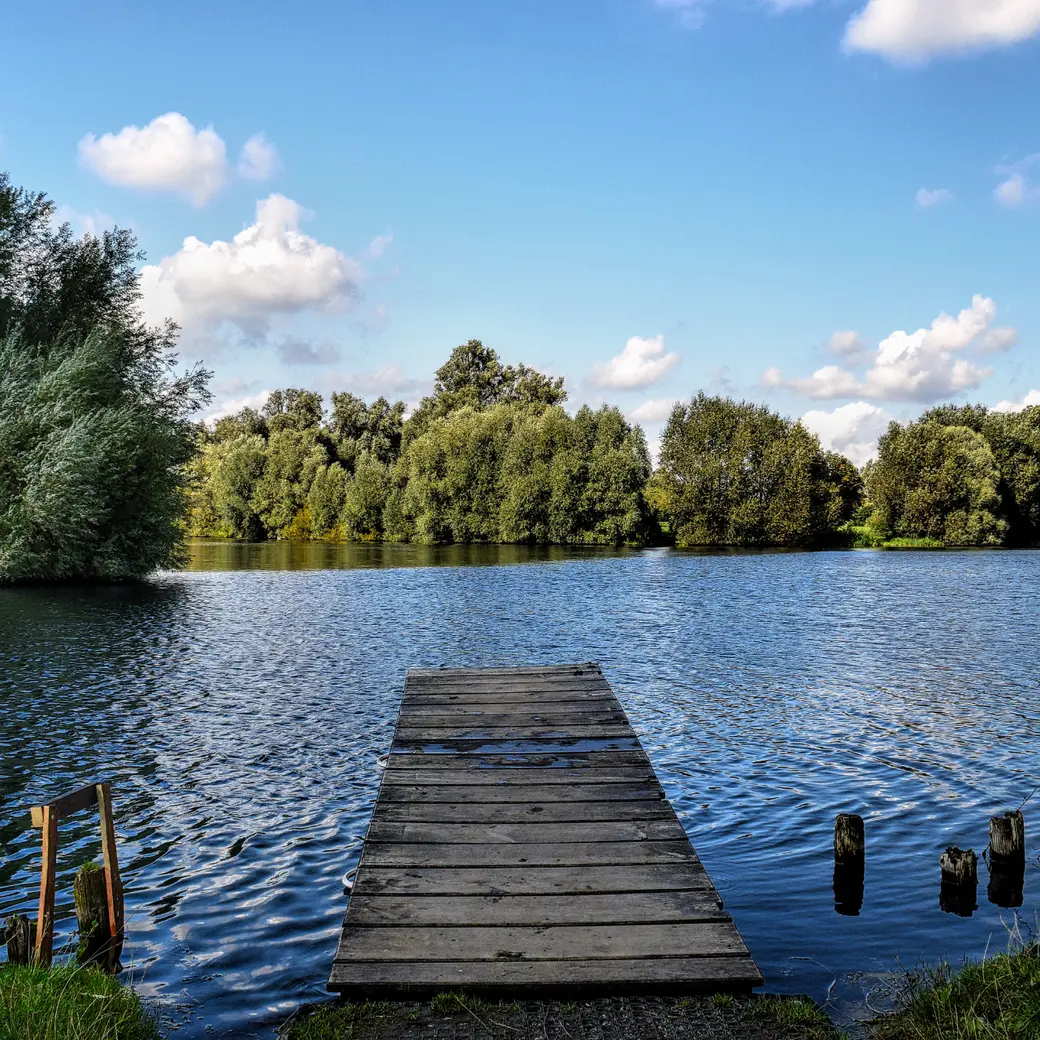
If you've spent any time around Lake Winnipesaukee recently, you've probably noticed something unusual: the water is extremely low.
Docks are sitting noticeably higher above the water, rocks and sections of shoreline that are normally submerged are exposed, and some boat owners have had to pull their boats earlier than they might in a typical year.
As we head into October 2026, Lake Winnipesaukee is once again experiencing notably low water levels, raising questions among homeowners, boaters and visitors.
Why is Lake Winnipesaukee so low? Is this normal for fall? And is this the lowest the lake has ever been?
Let's take a closer look.
Lake Winnipesaukee by the Numbers
Before talking about the current water level, it's worth remembering just how large Lake Winnipesaukee really is.
New Hampshire's largest lake is approximately:
• 28 miles long
• Up to 180 feet deep
• 43 feet deep on average
• About 72 square miles in surface area
• Home to roughly 260 islands
• Surrounded by approximately 240 miles of shoreline
• Holding an estimated 625 billion gallons of water
The lake's watershed encompasses more than 230,000 acres, and water entering that watershed ultimately plays an important role in maintaining the lake.
Lake Winnipesaukee is also a glacial lake and is known for remarkably clear water. In the main lake and many of its bays, average water visibility is approximately 27 to 29 feet.
All of that makes a change of even a foot or two in the lake's elevation significant, particularly along shallow shorelines.
How Low Is Lake Winnipesaukee in Fall 2026?
By late September 2026, Lake Winnipesaukee was being reported at approximately 502.75 feet in elevation.
The lake's established full-lake elevation is approximately 504.32 feet.
That means the lake was roughly 1.57 feet, or almost 19 inches, below full lake level as September came to a close.
For people who spend time on the lake, that difference can be dramatic.
A dock that normally has three feet of water at its end, for example, could have considerably less. Rocks that normally sit safely underwater may suddenly be near the surface, and shallow coves and channels can look completely different.
Is This the Lowest Lake Winnipesaukee Has Ever Been?
No.
While the lake is unusually low heading into October 2026, available historical records show that Lake Winnipesaukee has experienced substantially lower levels.
The U.S. Geological Survey has historical gauge records for Lake Winnipesaukee at Weirs Beach extending back to the 1930s.
According to USGS records, the lowest daily gauge height on record was 0.63 feet on December 11, 1941.
It's important to understand that USGS gauge height and lake elevation use different reference points, so those two numbers should not be directly compared without accounting for the gauge datum.
Using the historic USGS gauge datum, that 1941 reading corresponds to a lake elevation of approximately 500.55 feet.
For perspective, that's roughly 3.77 feet below the 504.32-foot full-lake elevation.
So while 2026 is certainly a low-water year, it would be inaccurate to call the current conditions an all-time record low.
Why Is Lake Winnipesaukee So Low?
The simplest answer is that lake levels are influenced by a combination of rainfall, evaporation, runoff and controlled releases of water through Lakeport Dam.
During the summer, evaporation removes a significant amount of water from the lake. The Lake Winnipesaukee Alliance estimates an average evaporation rate of approximately 22.5 inches per year.
At the same time, water must continue flowing out of Winnipesaukee into the Winnipesaukee River.
Normally, rainfall and runoff into the enormous watershed help replenish some of that water.
When rainfall doesn't keep pace, however, the lake gradually falls.
Isn't Lake Winnipesaukee Drawn Down Every Fall?
This is an important distinction.
Many New Hampshire lakes undergo scheduled fall drawdowns, when dams are intentionally operated to lower water levels for winter conditions, shoreline protection, maintenance and spring flood storage.
Lake Winnipesaukee is managed differently and isn't simply subjected to the same traditional fall drawdown process as many smaller lakes.
The lake naturally tends to decline from its spring level through the summer and fall because of evaporation and required downstream releases.
That means some lower water is completely normal by October.
What catches people's attention during a dry year is how much lower the lake becomes and how early those conditions appear.
What Does Low Water Mean for Boaters?
For anyone still boating this fall, low water makes caution especially important.
Rocks, shoals and underwater hazards may have considerably less water covering them than they did earlier in the season. Areas you've traveled through dozens of times may suddenly have less clearance.
Boaters should pay particular attention around:
• Shorelines
• Islands
• Shallow coves
• Channels
• Docks and breakwaters
• Known rocks and shoals
Fall is one of the most beautiful times to be on Winnipesaukee, but a low-water year is not the time to rely solely on your memory of where the deeper water usually is.
What Does This Mean for Lake Winnipesaukee Waterfront Homeowners?
Waterfront homeowners are often the first to notice just how dramatic a declining lake level can be.
Depending on the property, homeowners may experience docks that no longer reach adequate water, boats sitting much closer to the lake bottom, exposed rocks and considerably more shoreline than they're accustomed to seeing.
It can also affect when owners decide to remove boats and docks for the season.
But low-water years provide something else that's particularly interesting from a real estate perspective: they reveal characteristics of a waterfront property that aren't always obvious when the lake is full.
Buying Waterfront Property? Pay Attention to Water Depth
If you're considering buying a home on Lake Winnipesaukee or another New Hampshire lake, don't judge the waterfront solely by how it looks during one showing.
A beautiful sandy shoreline in June may look very different during an unusually dry September.
Some questions worth asking include:
How deep is the water at the end of the dock?
How does that depth change throughout the season?
Is the shoreline gradual or does it reach deep water relatively quickly?
Are there rocks or ledges that become problematic when the lake is low?
Can a boat still access the dock during low-water years?
What type and size of boat can realistically be accommodated?
Is the property located in a protected cove, open water or a particularly shallow area?
These details can matter tremendously to someone buying waterfront property, especially if boating is one of the reasons they're purchasing the home.
One of the Fascinating Things About Living on a New Hampshire Lake
Lake Winnipesaukee may be enormous, but it isn't static.
Its shoreline, water depth and appearance change with rainfall, snowmelt, evaporation, seasons and weather patterns.
That's part of lake living in New Hampshire.
The unusually low water we're seeing in fall 2026 offers a striking example of those natural fluctuations and an important reminder for anyone who owns, visits or is considering purchasing waterfront property.
If you're exploring a lakefront home, understanding the house is only part of the equation.
Understanding the waterfront itself can be just as important.
Categories
Recent Posts